Here are some photos of the first house, a rental, my family occupied in Apple Valley, sometime around 1958 (when I was 3), so I barely remember it myself. In 2017 I had occasion to pass through Apple Valley, and it occurred to me to see if the house still existed. So this page is partly about my detective work to determine if it did.
Here’s the large map of southern California, showing familiar coastline around Los Angeles, green bands representing the San Gabriel and San Bernardino Mountains to the north and northeast of LA, and the Mojave Desert beyond, from Palmdale in the west to Lucerne Valley and in the east. Palm Springs is in the lower right corner. (Click on the image for a larger one.)

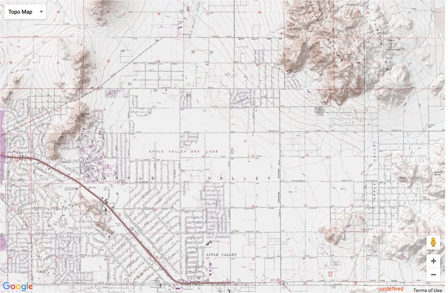
And here, from https://www.mytopo.com/maps/, is a topographical map of central Apple Valley, with Highway 18 angling down in the the lower left; a group of hills at the left, north of the highway, in the area of our later second Apple Valley house; and the sizeable Fairview Mountain in the northeast. The first Apple Valley house was near that.
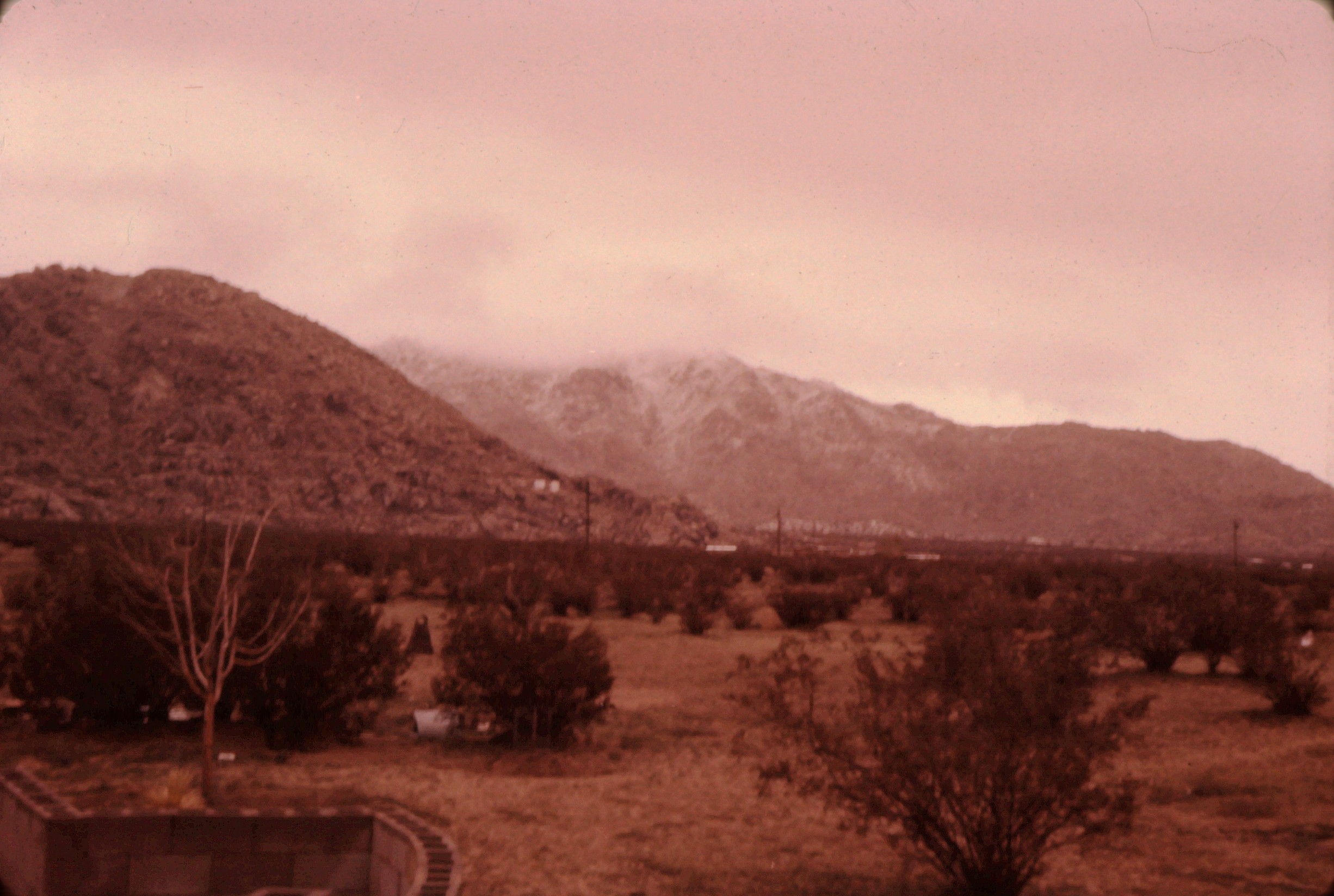
Now some photos of the house. From the boxes of my father’s old slides, these are the only ones of that house. (One of the photos pages does have a few more, of family visitors from Illinois.) Many of these old photos have faded, while a few of them have, oddly, retained their color. This first one is, unusually, a winter snow shot. (It didn’t snow in the desert very often.)
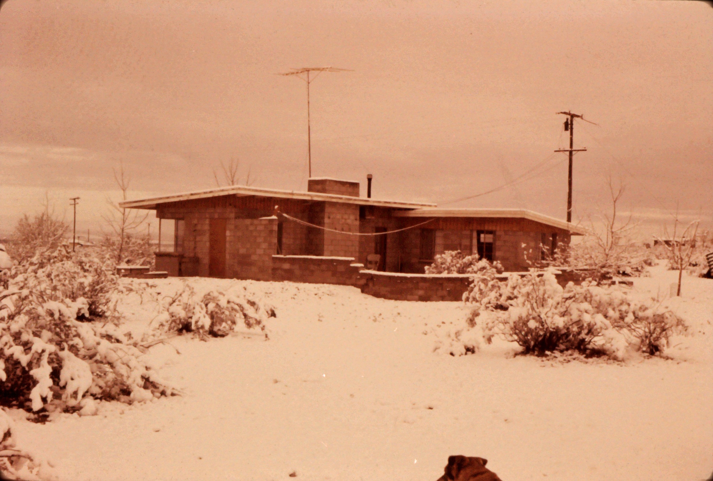
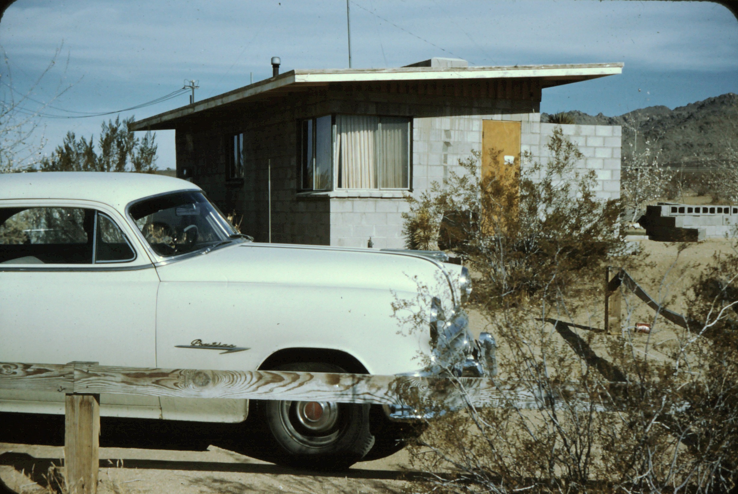
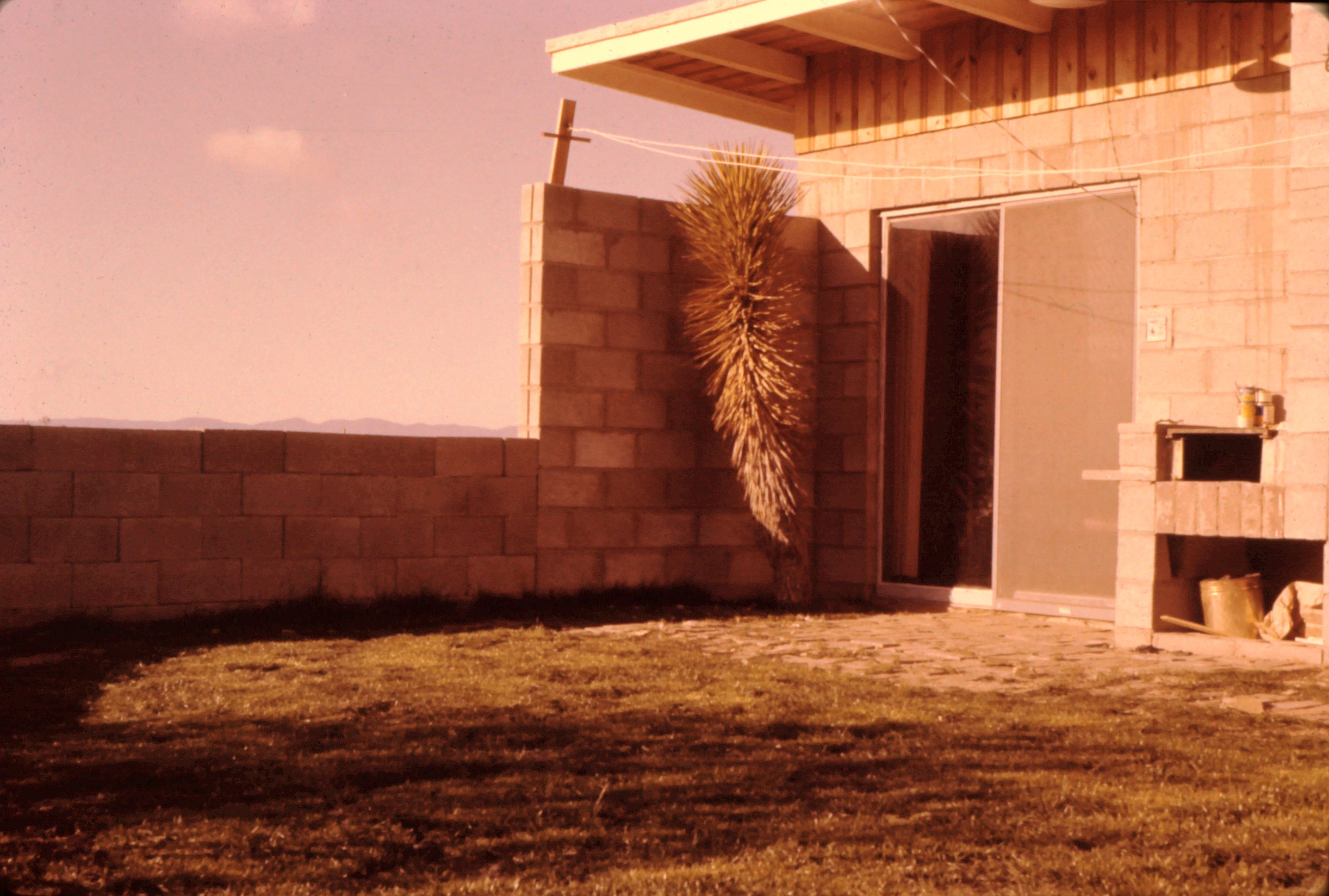
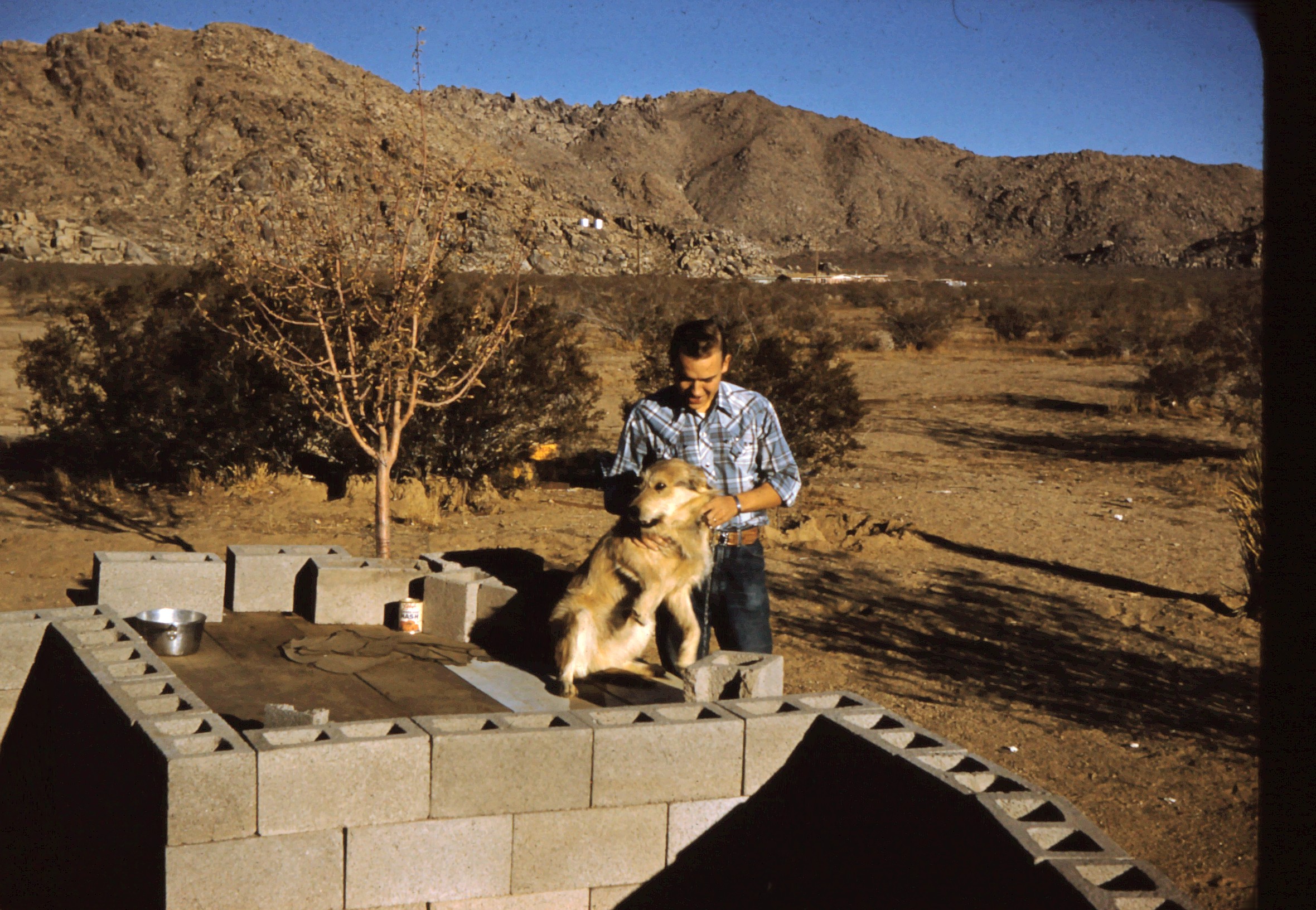
Here’s a front/side view, with somebody’s car (not my father’s). Then a corner of the back yard, with some grass. Then another corner of the back yard, with my father, who I suspect built that low cinder-block wall around the yard, and one of our two dogs.
There are no other telling photos of the house, though there are several of people in the back yard that I’ll post on a separate page.
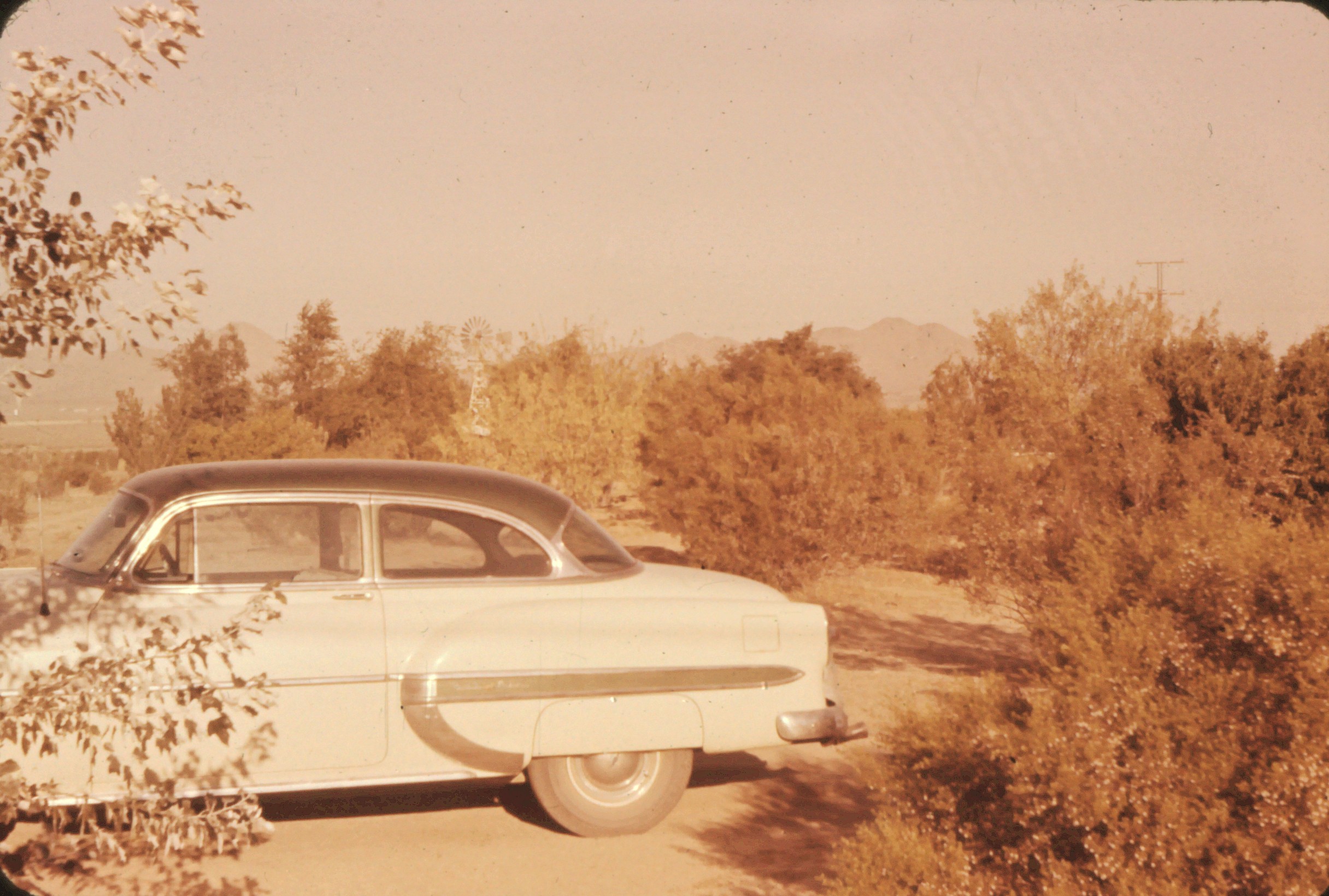
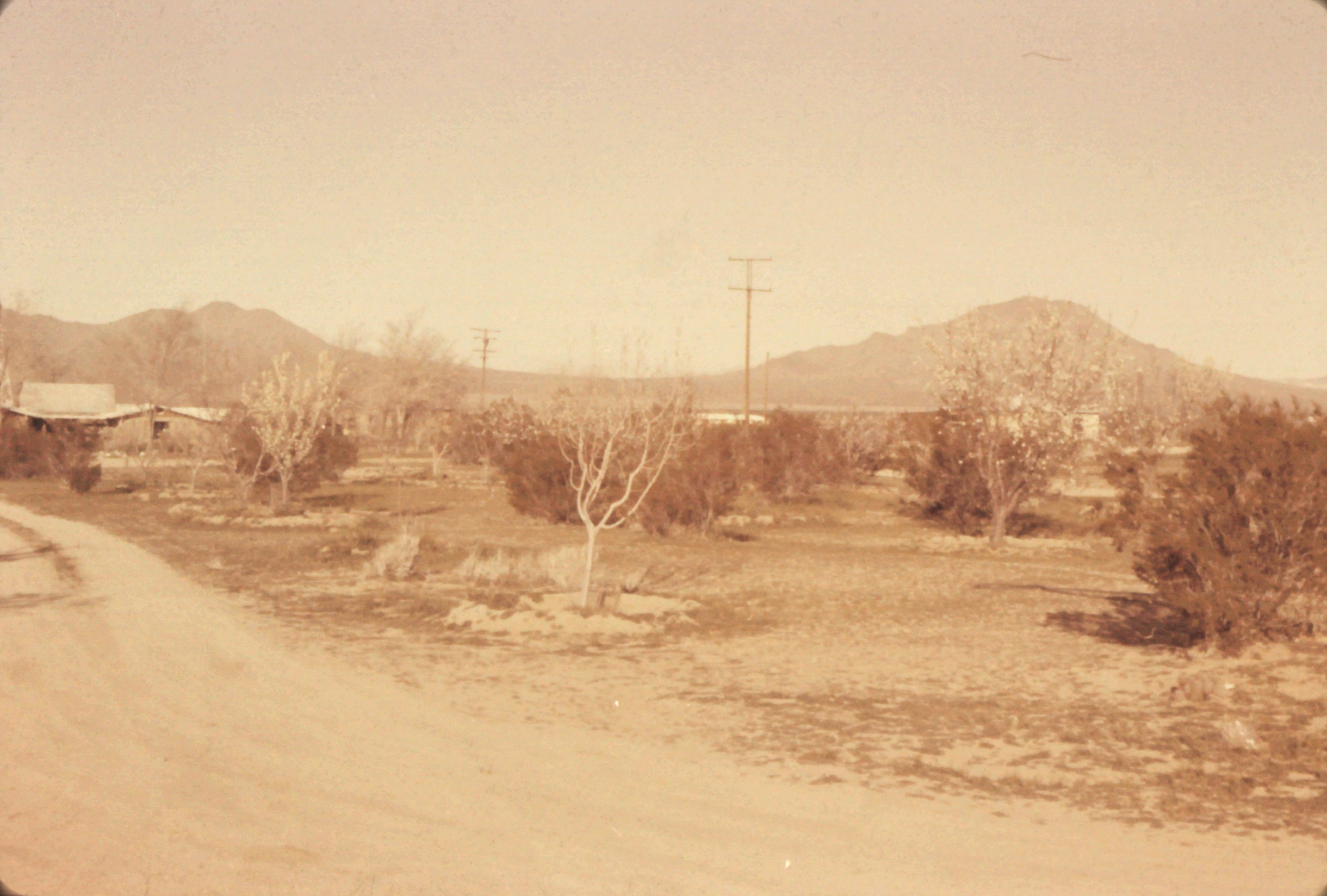
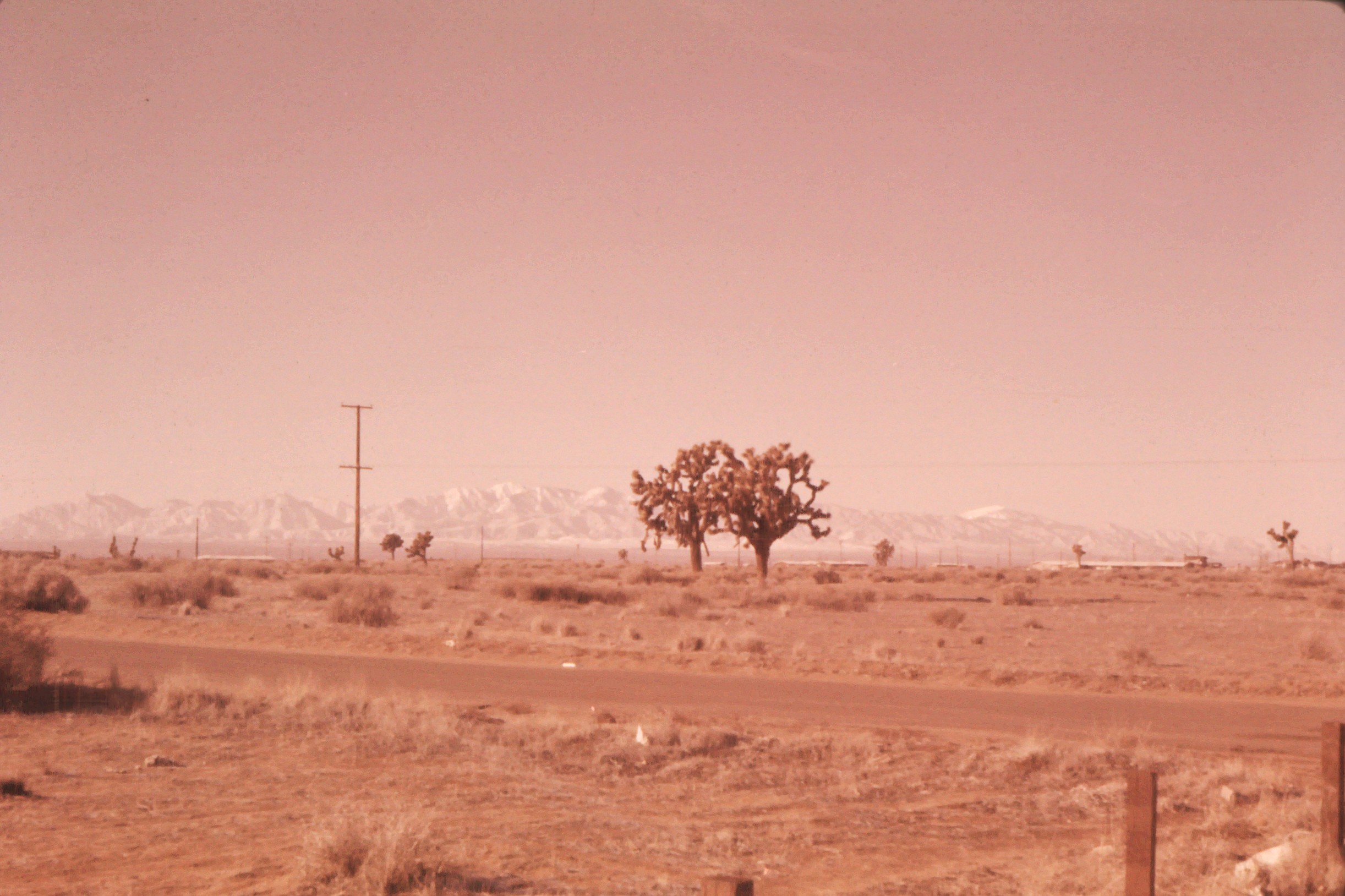
There was something called an “orchard” in front of the house, according to the descriptions hand-written on the slides. The first pic here shows my father’s car, a 1953 Chevy.

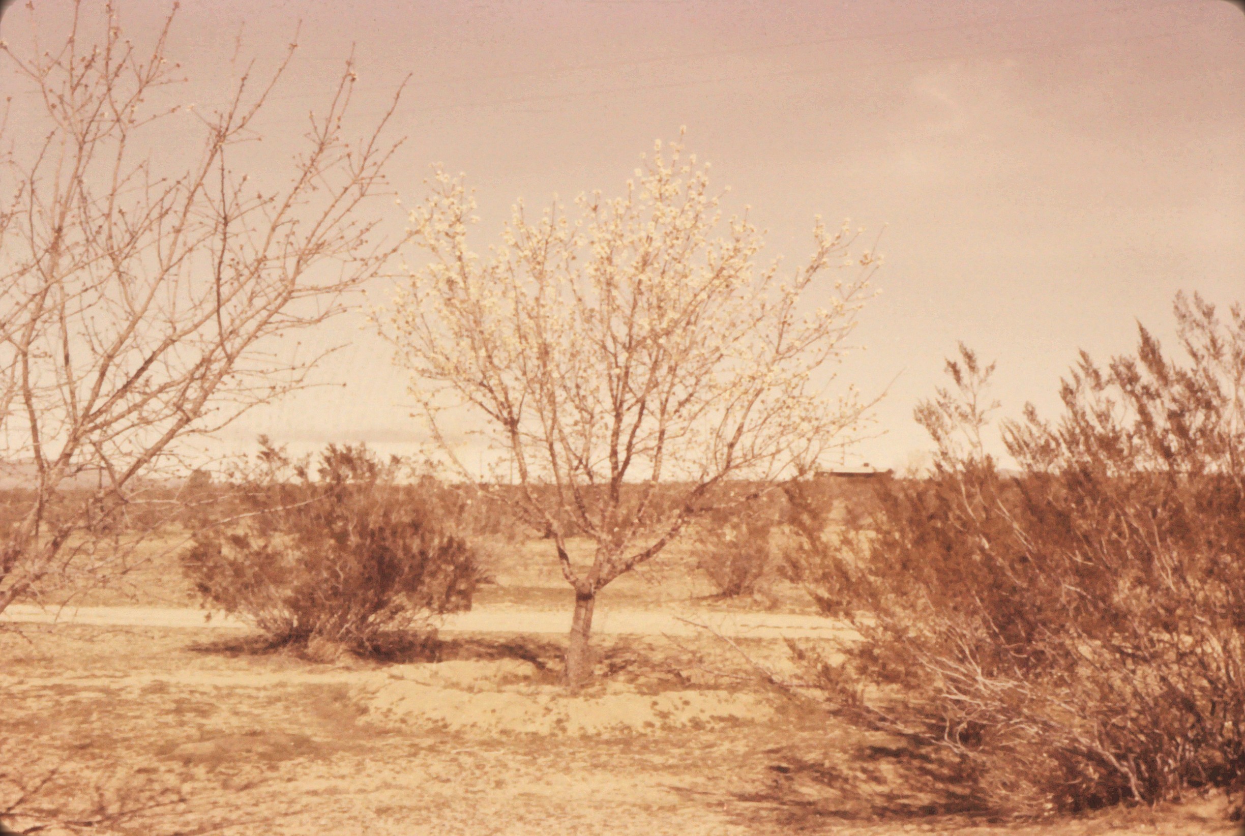
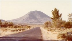
Here’s one showing the nearby hills to the east, with some snow; and two looking southwest across the valley, with the San Gabriel mountains blue in the distance.
Now, the question is, where exactly is, or was, this house? Years ago I drove out to the area and didn’t see it; but so many other houses had been built in the area by then, it was hard to tell exactly where it might have been.
More recently, last year and then again this week, I’ve use various online tools, Google and Topo Maps and real estate records at Zillow, to conclude that the house almost certainly doesn’t exist any more. However I can deduce almost exactly where it must have been.
First, a close up of the topo map of the area. Note, in two pictures above, two water tanks part way up the rocky hills to the east of the house, and note them marked on the map.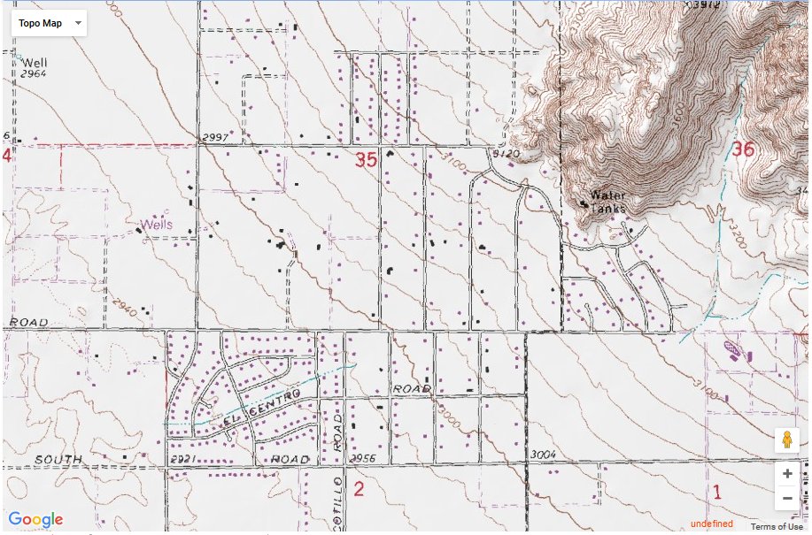
From the apparent angle of those water tanks, in the photo with my father and a dog in the foreground, the house must have been roughly south west of those tanks, perhaps just slightly to the north of a line perpendicular to them. So I examined all those streets in that direction from the tanks, via Google Maps in Earth mode. These streets are now more than half filled by houses built over the past 50 years.
If you go more than three or four streets west of the edge of the hills, and use Google Street View to look toward the hills, the water tanks are too far away. Has to be the third or fourth street.
What do we know about the house in question? It had a flat roof, a rectangular chimney, and seemed roughly L-shaped. It sat at the end of a dirt road or driveway, facing west, so that the back yard looked eastward toward the hills.
In Google Maps I haven’t found any such house. The newer houses all have beveled roofs. Two or three potential suspects (flat roofs but wrongly-shaped) I checked on Zillow, and sure enough they were built in 1951, or 1958. Using Google Street View, though, revealed nothing that resembled our house.
But I did see this house, at 17087 Century Plant Rd., built in 1958 and with a slightly sloped roof (the architect was influenced Frank Lloyd Wright, the description says). The Zillow listing has quite a few photos of it.
Now look back up at the fourth of the “orchard” group of photos above. There’s a mountain in the upper right — that’s Bell Mountain to the west — and a house at the left edge of the photo… with a slightly sloped roof that looks very much like 17087 Century Plant Rd.
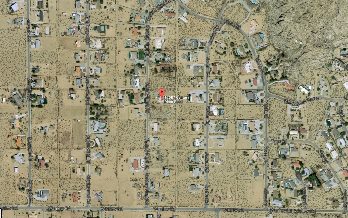
That address is just right of center on the small topo map above, on the third street west from the water tanks. Above is a Google Map Earth view of the area, with the address marked, and the water tanks in upper right. Two lots adjacent to this address are now empty. Was our house on one of them? Probably a bit further away, perhaps on a lot now occupied by another house. (Though it’s odd why anyone would have bothered to tear it down, with so many empty lots still in the area.)
So I must conclude the house is no longer there. I have only a couple fleeting memories from when we lived there — I was only 4 or 5 years old — so I feel no great sadness. The house we moved to next, the Second Apply Valley house, was much more important to me, and remained important to me for several decades.