More interesting juxtapositions showing how flat maps, especially Mercator projections, give misleading impressions of the relative sizes of areas on Earth.
Plus, an endpiece, about Piedmont Park.
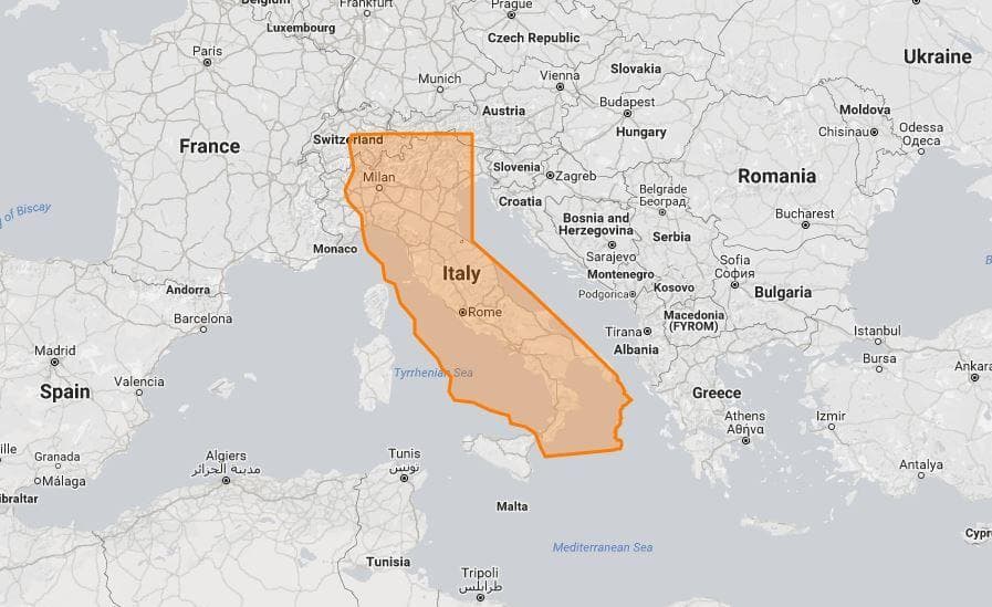
Here’s another item I came across on Fb. The site, Ranker, has a group of pages in a collection called “Geographical Findings,” which I haven’t explored beyond this one (which is from last March).
Ranker, Kellen Perry, 10 March 2021: 18 True Size Maps That Prove Maps Have Been Lying To You
The theme here is very similar to the post I did about a week ago, Misleading Maps, about how flat maps distort the relative sizes of nations and landmasses along the equator vs. to the far north and south.
The Ranker page is similar, juxtaposing nations, or US states and nations, against one another, to show, for example,
⦁ The continental US and Australia are roughly the same size;
⦁ Texas is quite small compared to Africa;
⦁ Greenland is *much smaller* than South American, despite those Mercator Maps;
⦁ Japan, put atop Greenland, is nearly as long
I’ll link one of the more striking images, above: how California is as long as Italy, but twice as fat.
(BTW I noticed that Saturday Night Live uses a huge Mercator projection of the world on the wall behind its “Weekend Update” desk.)
Endpiece
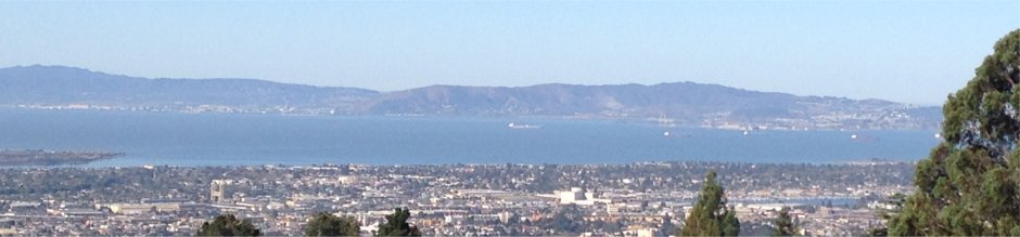
We’ve been doing walks outside more frequently, for exercise and just to get out of the house, since otherwise we are both homebodies these days. Usually just up and down the local streets. Yesterday I had the impulse to find someplace new to walk, and glancing over Google Maps in our area, spotted Piedmont Park, in the middle of Piedmont, an independent city northwest of us that happens to be completely surrounded by the city of Oakland.
Piedmont is a bit like Beverly Hills, an upscale enclave surrounded by a larger city (Oakland; Los Angeles). Piedmont is in a hilly area, and so occupied by many windy streets (many with fabulous views of the Bay, and of San Francisco), but in the core of the city near the park and City Hall, there are many expansive wide streets, all lined by enormous mansions. It would be worth an afternoon’s walk just to stroll up and down to look at architecture.
Does this link to Google Maps work? Zoom out a click and our house is in the lower right corner.
The park is small but pleasant, with a sunny, grassy area at the top northeast end, paved paths along both sides of a creek leading down the canyon, and athletic fields at the bottom, southwest end. Above along the north edge is Piedmont High School; at the bottom end is an elementary school.
(Exploring Google: this isn’t the Piedmont Park in Atlanta.)
Here’s a photo from the park’s grand entrance near the top, on Magnolia Avenue. (Open image in a new tab to see full-sized.)

We started at the top and walked down, discovering the athletic fields, then came back up the other side of the creek. The park was fairly busy. It was a sunny weekend afternoon, and the middle section of the park allowed dogs to run free. (Y wants a dog.) And maybe a quarter of people we passed wore masks. I still do, because I’m immune-compromised, as a result of my transplants.